Read the top Tips for Point Cloud to AutoCAD Conversion Services, and benefits for the Architectural, Electrical, and Construction industry.

What is Point Cloud Data?
A point cloud is an extensive collection of points collected by 3D laser scanners or other technologies to create a Point Cloud to AutoCAD or 3D models of existing structures.
Laser scanners collect millions of measured points, which are then used to generate massive point clouds that help describe the measured survey being carried out.
However, once you’ve obtained the entire point cloud, you’ll need to know what to do with it. This can be difficult for some surveyors with little or no experience with point clouds. It is not enough to simply have the software to prepare 2D drawings based on point clouds efficiently.
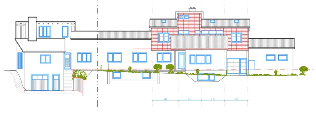
Converting raw measured point cloud data into suitable CAD deliverables such as floorplans, elevations, and topographic surveys requires developing new analytical skills and drafting methods that enable the draftsperson to make sense of the measured data.
Many surveyors increasingly use data collection platforms such as terrestrial laser scanners and unmanned aerial platforms to measure buildings and other similar assets.
Using 3D laser scanning and unmanned aircraft to aid in the development of as-built point cloud to AutoCAD documentation can save days or even weeks of valuable time.
Understanding the Basics of Point Cloud to AutoCAD Conversion
When it comes to creating digital representations of physical spaces, the process of converting point clouds to AutoCAD format is indispensable. But what exactly does this entail?
Let’s explore the fundamentals.
- Point clouds are dense sets of 3D data points captured by laser scanners or other surveying technologies. They represent the precise geometry and spatial relationships of physical objects within a scanned area.
- AutoCAD, on the other hand, is the primary software used for making fine detailed designs in 2D and 3D in different applications such as architecture engineering construction. In different areas such as architecture engineering construction and facility management, the conversion of data results within the point cloud to AutoCAD. It helps in the making of as-built documentation on which design visualization, clash detection as well as coordination are facilitated; besides, it supports renovation or retrofitting projects.
- Point cloud to CAD conversion involves importing point cloud data into AutoCAD software and using specialized tools to convert these raw data points into recognizable geometric objects, such as lines, curves, surfaces, and solid models. This conversion process essentially transforms real-world structures and environments into digital representations that can be further manipulated and analyzed within the AutoCAD environment.
Also Read, Convert Point Cloud Data to 3D Model Revit
Mastering Point Cloud to AutoCAD: 6 Quick Tips for BIM Success
1. Data Preparation is Key
It is critical to ensure that the “housekeeping” has been completed on your point cloud data before initiating the Scan to AutoCAD conversion—that is, noise is cleared, outliers are removed, and unnecessary points are decimated.
If you have the best quality point cloud data that would just lead to the development of more accurate CAD drawings and 3d models which nicely fit into your BIM workflow.
2. Choose the Right Software Tools
It is important to choose the right software tools for moving from Point Cloud to AutoCAD.
AEC professionals should seek solutions that are particularly designed for BIM workflows and that also have strong capabilities for processing and integrating point cloud data harmoniously.
Some of the software tools such as Revit and Recap Pro allow easy development of BIM models and processing point cloud data.
3. Maintain Consistent Coordinate Systems
Maintaining consistent coordinate systems in AutoCAD is crucial for ensuring accurate alignment and coordination of various elements within your drawings.
To prevent any misalignments in your BIM models you must ensure that your AutoCAD environment’s coordinate points work well with those in the point cloud data.
This is done by defining a base point, using absolute coordinates, and setting, and checking UCS orientation.
4. Utilize Segmentation and Classification
To organize your point cloud data into meaningful segments, it’s best to use segmentation and classification techniques.
Utilizing these tools enables you to concentrate on particular parts of the scanned environment to extract relevant information more efficiently for your BIM projects.
5. Validate and Verify
It is critical to validate and confirm the accuracy and precision of your converted Scan to AutoCAD files.
You must ensure consistency and alignment by doing quality checks through comparison with reference measurements, cross-section analysis, overlay visualizations, dimensional checks, and clash detection.
Generally, BIM consulting companies have a quality manager, who validates and verifies the accuracy of the final deliverables.
6. Document Your Workflow
For you to keep transparency and consistency in your BIM projects, it is important to document how you convert point clouds into AutoCAD.
One should store detailed records on how the conversion process is done to include software settings as well as parameters or manually adjusted items.
Other than being a source of advice for future undertakings; this procedure also enhances efforts by members working together by imparting understanding among themselves.
Software to Convert Point Cloud to CAD Drawing


What are the benefits of Point Cloud to AutoCAD Conversion Services?
In the realm of design and engineering, the conversion of point cloud data to AutoCAD format offers a multitude of benefits, revolutionizing the way we conceptualize, visualize, and execute projects.
Let’s explore the advantages of this transformative process:
How to Convert Paper Drawing to CAD?
To Convert Paper Drawing to CAD requires a few simple steps for developing precise AutoCAD drawings that are usable by project stakeholders for effective design planning and coordination.
See below a step-by-step explanation of converting paper to CAD:
1. Improved Project Collaboration
In boosting cooperation across all who are associated with the project, transforming point cloud to AutoCAD promotes improved coordination.
Enhanced collaboration enables experts to share project details and examine them visually.
This makes it easier for them to comprehend issues, ask questions, and make recommendations and suggestions or modifications on new solutions, which are continuously improved by multiple iterations in response to feedback from stakeholders and clients.
2. Data-Driven Decision Making
The use of point cloud data in AutoCAD has enabled professionals to use data to direct decisions during all phases of a project.
It has enabled them to consider different design options, determine if they are feasible, and come up with the optimal solution that is based on practical considerations.
When integrated with AutoCAD, scans can lead to better visualization, provide sound judgment on what already exists, and produce a design that matches its surroundings.
3. Cost and Time Savings
The projects get saved in time and cost by using point cloud to AutoCAD conversion which comes with increased efficiency and accuracy making tangible results to this effect.
It enhances the efficiency of service delivery by minimizing errors that come with manual measurements besides making it more effective and cheap through workflow streamlining, hence resulting in profits for clients as well as satisfaction.
4. Accurate As-Built Documentation
The ability to convert point cloud information into digitized form for documentation purposes allows capturing details about the structures as they exist in real life.
This way architects or surveyors can create drawings based on actual measurements taken at the site without distorting any measurements.
Furthermore, through point cloud to AutoCAD conversion, one can produce detailed drawings in the form of blueprints which can be used during renovation processes.
5. Efficient Clash Detection and Coordination
AutoCAD’s robust tools for clash detection and coordination when used in combination with point cloud data become even more powerful.
When point clouds are converted to AutoCAD, designers can detect potential conflicts between design elements and existing structures at the early stage of design, thereby reducing rework and ensuring smoother project execution.
Conclusion
Point Cloud to AutoCAD Services are in high demand these days because they take very little time and have a low chance of error in site measurement.
On-site conventional measurement takes a long time to generate structure data. Point cloud modeling demonstrates that scanning takes very little time, and analysis by team members who work on the software is very up-to-date.
There is also the use of laser scanners to capture real data, which takes only a few hours when compared to traditional methods, which can take not only a few days but also months.
It is also critical for clients to understand that the scan files generated during scanning are primarily in point format, and they have no practical application.
While there are diverse applications of Scan to AutoCAD, it is critical to follow experts tips for successful BIM integration.
Some of these practices include data preparation, choosing the right software, maintaining consistent coordinate systems, utilizing segmentation, validating and verifying Scan to AutoCAD files, and documenting your workflow.S
Related Posts
Our Recent CAD Conversion Projects
Share Via
Tags
- autocad point cloud, point cloud autodesk, point cloud to 2d drawing, point cloud to 3d model autocad, point cloud to autocad, point cloud to autocad conversion, point cloud to autocad conversion services, point cloud to cad, point cloud to cad conversion, point cloud to cad conversion services, point cloud to dwg, point clouds in autocad, scan to cad, working with point clouds in autocad

Devashish Sharma
Devashish is Founder/Director at Cresire where he leads BIM services. He holds a bachelor’s degree in Civil Engineering from the University of Sheffield and an MSc in Construction Project Management from The University of the West of England. His vision behind CRESIRE is to provide BIM services, adhering to best practices and procedures, to global customers, helping customers to save extensive production costs and overruns.


